


Campbell, Goshen, Platte, Johnson, Washakie, Weston, Crook & Niobrara Counties PUMA, Wyoming
About
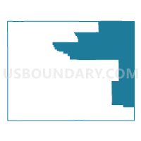
Outline

Summary
| Unique Area Identifier | 194427 |
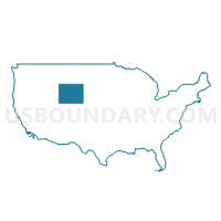
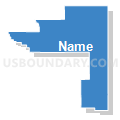
| Name | Campbell, Goshen, Platte, Johnson, Washakie, Weston, Crook & Niobrara Counties PUMA |
| State | Wyoming |
| Area (square miles) | 23,460.32 |
| Land Area (square miles) | 23,383.54 |
| Water Area (square miles) | 76.78 |
| % of Land Area | 99.67 |
| % of Water Area | 0.33 |
| Latitude of the Internal Point | 43.65180980 |
| Longtitude of the Internal Point | -105.42705330 |
Maps
Graphs
Select a template below for downloading or customizing gragh for Campbell, Goshen, Platte, Johnson, Washakie, Weston, Crook & Niobrara Counties PUMA, Wyoming


Neighbors
Neighoring Public Use Microdata Area (by Name) Neighboring Public Use Microdata Area on the Map
- East Montana (Outside Billings City) PUMA, MT
- Lakota Region PUMA, SD
- Laramie & Albany Counties PUMA, WY
- Natrona, Carbon & Converse Counties PUMA, WY
- North Central & Northwest Nebraska PUMA, NE
- Sheridan, Park, Teton, Lincoln & Big Horn Counties PUMA, WY
- Sweetwater, Fremont, Uinta, Sublette & Hot Springs Counties--Wind River Reservation PUMA, WY
- West South Dakota--Rapid City PUMA, SD
Top 10 Neighboring County (by Population) Neighboring County on the Map
- Pennington County, SD (100,948)
- Laramie County, WY (91,738)
- Natrona County, WY (75,450)
- Campbell County, WY (46,133)
- Fremont County, WY (40,123)
- Scotts Bluff County, NE (36,970)
- Albany County, WY (36,299)
- Sheridan County, WY (29,116)
- Park County, WY (28,205)
- Lawrence County, SD (24,097)
Top 10 Neighboring County Subdivision (by Population) Neighboring County Subdivision on the Map
- Gillette North CCD, Campbell County, WY (30,768)
- Sheridan CCD, Sheridan County, WY (21,451)
- Gillette South CCD, Campbell County, WY (15,365)
- Torrington CCD, Goshen County, WY (11,420)
- Douglas CCD, Converse County, WY (9,537)
- Cheyenne East CCD, Laramie County, WY (8,642)
- Worland CCD, Washakie County, WY (7,803)
- Buffalo CCD, Johnson County, WY (7,737)
- Cheyenne West CCD, Laramie County, WY (7,254)
- Hells Half Acre CCD, Natrona County, WY (6,942)
Top 10 Neighboring Place (by Population) Neighboring Place on the Map
- Gillette city, WY (29,087)
- Torrington city, WY (6,501)
- Worland city, WY (5,487)
- Buffalo city, WY (4,585)
- Wheatland town, WY (3,627)
- Newcastle city, WY (3,532)
- Wright town, WY (1,807)
- Antelope Valley-Crestview CDP, WY (1,658)
- Lusk town, WY (1,567)
- Sleepy Hollow CDP, WY (1,308)
Top 10 Neighboring Elementary School District (by Population) Neighboring Elementary School District on the Map
- Broadus Elementary School District, MT (1,371)
- Alzada Elementary School District, MT (159)
- Biddle Elementary School District, MT (117)
Top 10 Neighboring Secondary School District (by Population) Neighboring Secondary School District on the Map
Top 10 Neighboring Unified School District (by Population) Neighboring Unified School District on the Map
- Laramie County School District 1, WY (86,198)
- Natrona County School District 1, WY (75,450)
- Campbell County School District 1, WY (46,133)
- Albany County School District 1, WY (36,299)
- Sheridan County School District 2, WY (24,064)
- Spearfish School District 40-2, SD (15,452)
- Goshen County School District 1, WY (13,164)
- Converse County School District 1, WY (9,557)
- Johnson County School District 1, WY (8,569)
- Belle Fourche School District 09-1, SD (7,962)
Top 10 Neighboring State Legislative District Lower Chamber (by Population) Neighboring State Legislative District Lower Chamber on the Map
- State House District 30, SD (24,446)
- State House District 31, SD (24,097)
- State House District 31, WY (14,418)
- State House District 52, WY (12,056)
- State House District 32, WY (11,250)
- State House District 58, WY (10,860)
- State House District 10, WY (10,403)
- State House District 7, WY (10,209)
- State House District 40, WY (9,987)
- State House District 28B, SD (9,885)
Top 10 Neighboring State Legislative District Upper Chamber (by Population) Neighboring State Legislative District Upper Chamber on the Map
- State Senate District 47, NE (32,377)
- State Senate District 49, NE (31,705)
- State Senate District 23, WY (26,474)
- State Senate District 30, SD (24,446)
- State Senate District 31, SD (24,097)
- State Senate District 30, WY (20,562)
- State Senate District 28, SD (19,903)
- State Senate District 6, WY (19,877)
- State Senate District 24, WY (19,659)
- State Senate District 22, WY (19,515)
Top 10 Neighboring 111th Congressional District (by Population) Neighboring 111th Congressional District on the Map
- Congressional District (at Large), MT (989,415)
- Congressional District (at Large), SD (814,180)
- Congressional District (at Large), WY (563,626)
- Congressional District 3, NE (561,378)
Top 10 Neighboring Census Tract (by Population) Neighboring Census Tract on the Map
- Census Tract 1, Campbell County, WY (8,924)
- Census Tract 7, Campbell County, WY (8,828)
- Census Tract 9653, Park County, WY (7,155)
- Census Tract 9677, Butte County, SD (7,138)
- Census Tract 20, Laramie County, WY (7,130)
- Census Tract 9594, Platte County, WY (6,575)
- Census Tract 5, Sheridan County, WY (6,541)
- Census Tract 2, Campbell County, WY (6,441)
- Census Tract 5, Campbell County, WY (6,365)
- Census Tract 9552, Johnson County, WY (6,094)
Top 10 Neighboring 5-Digit ZIP Code Tabulation Area (by Population) Neighboring 5-Digit ZIP Code Tabulation Area on the Map
- 82009, WY (31,703)
- 82718, WY (23,003)
- 82716, WY (18,747)
- 57783, SD (14,290)
- 82240, WY (10,235)
- 82633, WY (9,592)
- 57717, SD (8,007)
- 82401, WY (7,866)
- 82834, WY (7,585)
- 82201, WY (6,467)